OrbitGIS Microdrone Airborne Mapping Extension 1.0
Request
Download
link when available

OrbitGIS Microdrone Airborne Mapping Extension 1.0

Free The Microdrone Airborne Mapping extension to Orbit GIS offers automated flight
Rating
Your vote:
Latest version:
1.0 See all
Developer:
Orbit GeoSpatial Technologies
Screenshots
1 / 2
Freeware
Request
Download
link when available

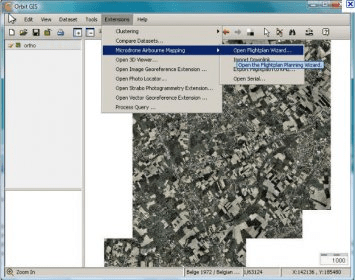
The Orbit GIS Microdrone Airborne Mapping Extension provides users with the necessary tools for automated flight and high-precision mapping. It includes a Waypoint Generator, a Microdrone in-flight tracker, and a captation tool. Additionally, Strabo Photogrammetry extension can be used for image processing, stereoprocessing, and orthorectification.

Comments

User

Your vote: